About
About me

Geospatial Analyst & Remote Sensing specialist
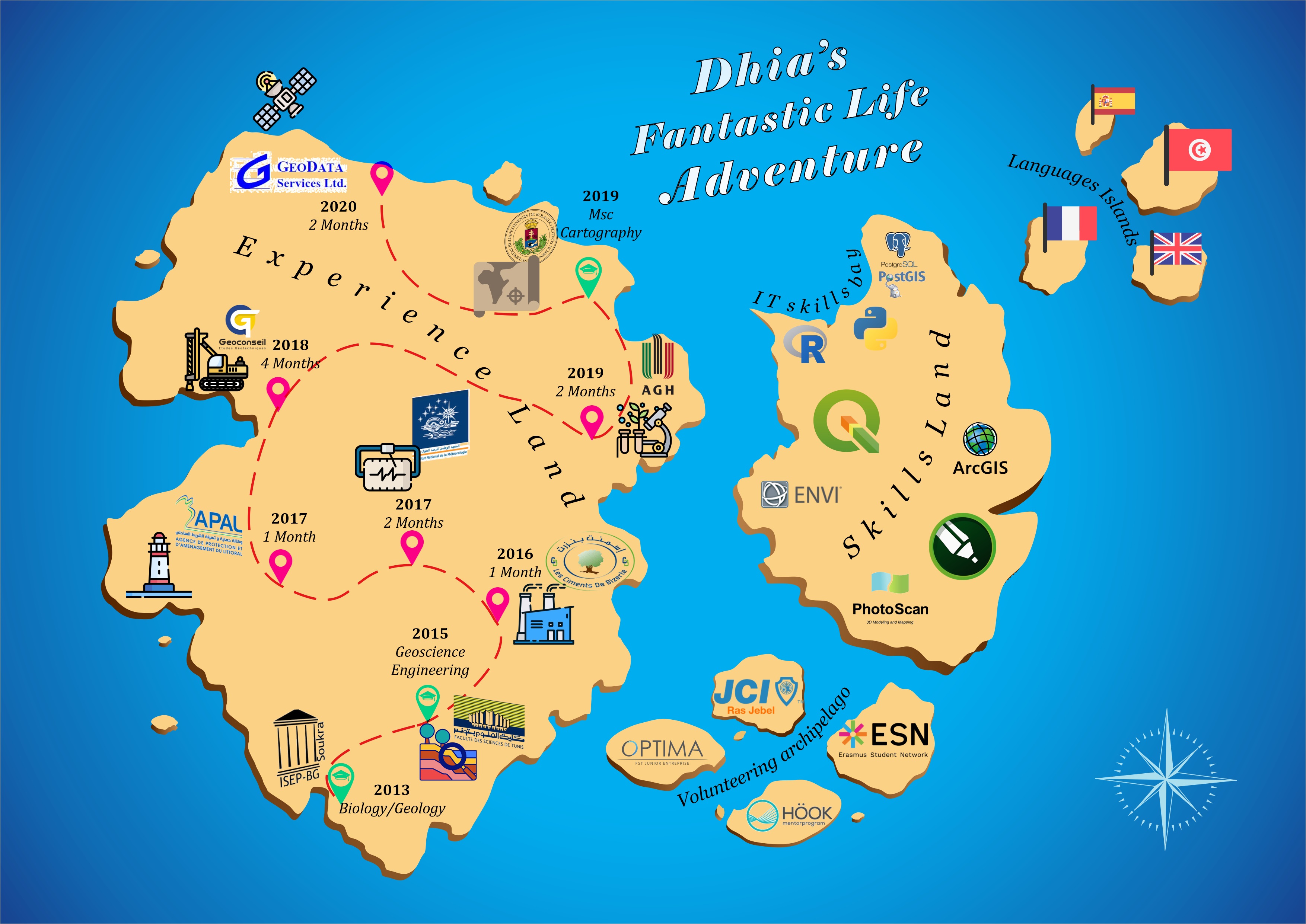
I transform geospatial data into clear, actionable insights for organizations. With experience in geospatial data science, GIS development, and Earth observation, I bridge remote sensing, spatial analysis, and machine learning to support smarter decision-making in urban planning, environmental monitoring, precision agriculture, and transportation analysis. I have worked on projects involving Python, PyTorch, PostgreSQL/PostGIS, QGIS, and ArcGIS to build spatial databases, artificial intelligence models, and web mapping solutions. I thrive in collaborative environments where data science and GIS innovation meet real-world challenges. Feel free to connect ! I enjoy meeting people passionate about geospatial intelligence, AI, and applied data science.
- Birthday: 1994
- Website: https://turkim1.github.io/AboutMe/
- Availability: France
- Degree: Master in Cartography & Geoinformatics
- Email: turki.mdhia@gmail.com
Determined, passionate, reliable. I dream big and I work hard.
SKILLS
Programming
Python
R
Javascript
Software and Tools
QGIS
ArcGIS Pro
ESA-SNAP
eCognition
ENVI
Open Layers
git
Cloud based platforms
Google Earth Engine
Google Cloud